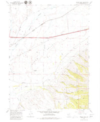
1967 Map of Herder Creek
USGS Topo · Published 1979About this map
Starr Valley serves as the focal point of this late 1960s Elko County landscape, where the agricultural and social life of the community is anchored by the Starr Valley Community Hall and the nearby Starr Valley Cem. The map illustrates a complex transportation corridor where the Southern Pacific and Western Pacific railroads run nearly parallel, complemented by an older, bypassed Old Railroad Grade to the north. These infrastructure lines transition from the flatlands into the rising slopes of the Humboldt National Forest.
Find a feature on this map
36 named features on this map. Tap any name to fly to it.
Don’t see what you’re looking for? This feature index may not catch every label — zoom into the map to look around manually.
Map Details
Editions of this 1967 Herder Creek Map
2 editions found

Other maps of this area

1935 · Halleck
USGS Topo · 1:125,000

1955 · Wells
USGS Topo · 1:250,000

1955 · Elko
USGS Topo · 1:250,000

1958 · Wells
USGS Topo · 1:250,000

1958 · Elko
USGS Topo · 1:250,000

1961 · Wells
USGS Topo · 1:250,000

1962 · Elko
USGS Topo · 1:250,000

1965 · Elko
USGS Topo · 1:250,000

1967 · Welcome
USGS Topo · 1:24,000

1967 · Twin Buttes
USGS Topo · 1:24,000