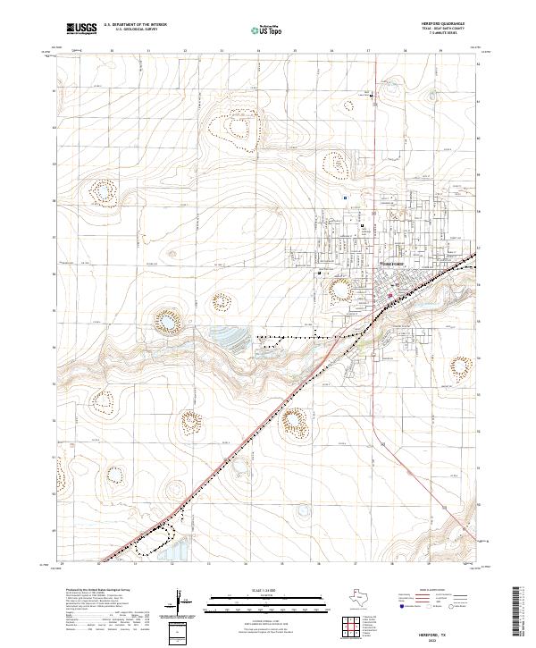
2022 Map of Hereford
USGS Topo · Published 2022About this map
The Deaf Smith County Courthouse stands at the civic heart of Hereford, the primary settlement shown in this High Plains survey. The landscape is defined by the winding course of Tierra Blanca Cr and the ephemeral drainage of Frio Draw, illustrating the critical role of water management in this agricultural region. The town’s spatial organization is revealed through its dense grid of residential and commercial streets, including Dairy Rd and W Park Ave, while the surrounding rural areas are partitioned by an extensive network of county roads like Co Rd 9 and Co Rd 4. Local heritage is anchored by sites such as Rest Lawn Cem, Saint Anthonys Cem, and West Park Cem, providing essential points of reference for genealogists and local historians studying the growth of this Texas Panhandle community.
Find a feature on this map
133 named features on this map. Tap any name to fly to it.
Don’t see what you’re looking for? This feature index may not catch every label — zoom into the map to look around manually.
Map Details
Editions of this 2022 Hereford Map
This is the sole edition of this map. No revisions or reprints were ever made.
Other maps of this area

1954 · Clovis
USGS Topo · 1:250,000

1958 · Clovis
USGS Topo · 1:250,000

1966 · Jumbo
USGS Topo · 1:24,000

1966 · Easter
USGS Topo · 1:24,000

1966 · Summerfield
USGS Topo · 1:24,000

1970 · Hereford
USGS Topo · 1:24,000

1971 · Westway
USGS Topo · 1:24,000

1971 · Hereford NE
USGS Topo · 1:24,000
1971 · Milo Center
USGS Topo · 1:24,000

1971 · Hereford SE
USGS Topo · 1:24,000