
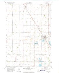
1973 Map of Herman NW
USGS Topo · Published 1975About this map
The agrarian townships of North Ottawa and Gorton define this section of Grant County, where the landscape is organized by a precise grid of rural section lines and drainage ditches. The Mustinka River winds through the southern portion of the quadrangle, contrasted by the straight-line trajectory of the Burlington Northern railroad that cuts diagonally across the prairie. This rail corridor was essential for the movement of grain and goods, connecting small loading points like Bullis to larger markets.
Find a feature on this map
9 named features on this map. Tap any name to fly to it.
Don’t see what you’re looking for? This feature index may not catch every label — zoom into the map to look around manually.
Map Details
Editions of this 1973 Herman NW Map
This is the sole edition of this map. No revisions or reprints were ever made.
Other maps of this area

1910 · Wendell
USGS Topo · 1:62,500

1911 · Herman
USGS Topo · 1:62,500

1913 · Wendell
USGS Topo · 1:62,500

1951 · Wheaton
USGS Topo · 1:62,500

1951 · Campbell
USGS Topo · 1:62,500

1953 · Milbank
USGS Topo · 1:250,000

1953 · Fargo
USGS Topo · 1:250,000

1956 · Fargo
USGS Topo · 1:250,000

1958 · Milbank
USGS Topo · 1:250,000
1973 · Herman
USGS Topo · 1:24,000