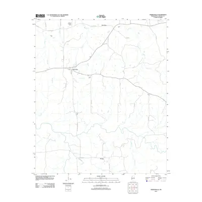
2012 Map of Hermanville
USGS Topo · Published 2012About this map
Hermanville and Barland serve as the primary hubs in this portion of Claiborne County, where the landscape is defined by the winding course of Little Bayou Pierre and its many tributaries. The area is notable for its high density of family and community burial grounds, including Center Cem, Jones Cem, and French Cem, which offer significant value for genealogical research in this rural Mississippi corridor. Transportation and utility are reflected in the presence of Railroad Ave in Hermanville and the secluded Valley of the Moon Airport to the north. Smaller watercourses like Booths Cr and Whisky Br carve through the terrain, leading toward distinctive natural landmarks such as Rocky Falls. The map documents a rural network of haul roads and family-named routes like Pattison Hermanville Rd and Williams Rd, illustrating the persistent land use patterns of the early 21st century.
Find a feature on this map
40 named features on this map. Tap any name to fly to it.
Don’t see what you’re looking for? This feature index may not catch every label — zoom into the map to look around manually.
Map Details
Editions of this 2012 Hermanville Map
This is the sole edition of this map. No revisions or reprints were ever made.
Other maps of this area

1939 · Yokena
USGS Topo · 1:62,500

1953 · Natchez
USGS Topo · 1:250,000

1955 · Jackson
USGS Topo · 1:250,000

1956 · Natchez
USGS Topo · 1:250,000

1959 · Natchez
USGS Topo · 1:250,000

1961 · Jackson
USGS Topo · 1:250,000

1962 · Jackson
USGS Topo · 1:250,000

1962 · Utica West
USGS Topo · 1:24,000

1963 · Carlisle
USGS Topo · 1:24,000

1963 · Port Gibson
USGS Topo · 1:24,000