
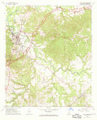
1963 Map of Port Gibson
USGS Topo · Published 1964About this map
Port Gibson serves as the focal point of this Claiborne County survey, where the town’s established street grid meets the winding course of Bayou Pierre. The educational history of the region is well-represented by the Chamberlain-Hunt Academy and Addison High Sch, while local genealogy is grounded in sites like Wintergreen Cemetery and Wilson Cemetery. The Illinois Central railroad and the Natchez Trace Parkway cut across the landscape, illustrating the evolution of Mississippi transportation from rail to modern scenic corridors. Beyond the main town, smaller settlements like Pattison and Gordon are connected by a network of rural roads and country churches, including Welcome Church and King David Church, which anchor the surrounding communities amidst the tributaries of Little Bayou Pierre and Bakers Creek.
Find a feature on this map
25 named features on this map. Tap any name to fly to it.
Don’t see what you’re looking for? This feature index may not catch every label — zoom into the map to look around manually.
Map Details
Editions of this 1963 Port Gibson Map
2 editions found
Other maps of this area

1939 · Yokena
USGS Topo · 1:62,500

1939 · Lorman
USGS Topo · 1:62,500

1953 · Natchez
USGS Topo · 1:250,000

1955 · Jackson
USGS Topo · 1:250,000

1956 · Natchez
USGS Topo · 1:250,000

1958 · St. Joseph
USGS Topo · 1:62,500

1959 · Natchez
USGS Topo · 1:250,000

1961 · Jackson
USGS Topo · 1:250,000

1962 · Jackson
USGS Topo · 1:250,000

1963 · Carlisle
USGS Topo · 1:24,000