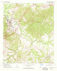
1963 Map of Port Gibson
USGS Topo · Published 1970About this map
The town of Port Gibson serves as the focal point of this 1960s-era landscape, where the confluence of historic travel routes and intricate waterways defines the topography. The Natchez Trace Parkway arcs through the countryside, intersecting the iron path of the Illinois Central railroad. This region is dense with landmarks of local heritage, from the prominent Chamberlain-Hunt Academy and Addison High Sch to the sacred grounds of Wintergreen Cem and Scott Cem.
Find a feature on this map
27 named features on this map. Tap any name to fly to it.
Don’t see what you’re looking for? This feature index may not catch every label — zoom into the map to look around manually.
Map Details
Editions of this 1963 Port Gibson Map
2 editions found

Other maps of this area

1939 · Yokena
USGS Topo · 1:62,500

1939 · Lorman
USGS Topo · 1:62,500

1953 · Natchez
USGS Topo · 1:250,000

1955 · Jackson
USGS Topo · 1:250,000

1956 · Natchez
USGS Topo · 1:250,000

1958 · St. Joseph
USGS Topo · 1:62,500

1959 · Natchez
USGS Topo · 1:250,000

1961 · Jackson
USGS Topo · 1:250,000

1962 · Jackson
USGS Topo · 1:250,000

1963 · Carlisle
USGS Topo · 1:24,000