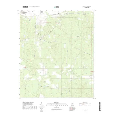
2018 Map of Hermanville
USGS Topo · Published 2018About this map
Hermanville and the surrounding Claiborne County countryside are defined by a complex network of creeks and small family cemeteries that trace the area's ancestral roots. The landscape is bisected by the Little Bayou Pierre, with numerous tributaries like Whisky Br, Booths Cr, and Barland Cr carving through the terrain. Evidence of the region's long-established communities is found in the high density of burial grounds, including the Old Mount Tró Grove Cem, Shield Cem, and Patona Cem. To the northwest, the Natchez Trace Parkway follows the ancient path of the historic wilderness road, while the small settlement of Saint Elmo sits near the headwaters of Stormy Cr. The presence of the Valley of the Moon Airport and several winding secondary roads like Pattison Rd and State Hwy 548 highlight the rural connectivity of this Mississippi landscape.
Find a feature on this map
49 named features on this map. Tap any name to fly to it.
Don’t see what you’re looking for? This feature index may not catch every label — zoom into the map to look around manually.
Map Details
Editions of this 2018 Hermanville Map
This is the sole edition of this map. No revisions or reprints were ever made.
Other maps of this area

1939 · Yokena
USGS Topo · 1:62,500

1953 · Natchez
USGS Topo · 1:250,000

1955 · Jackson
USGS Topo · 1:250,000

1956 · Natchez
USGS Topo · 1:250,000

1959 · Natchez
USGS Topo · 1:250,000

1961 · Jackson
USGS Topo · 1:250,000

1962 · Jackson
USGS Topo · 1:250,000

1962 · Utica West
USGS Topo · 1:24,000

1963 · Carlisle
USGS Topo · 1:24,000

1963 · Port Gibson
USGS Topo · 1:24,000