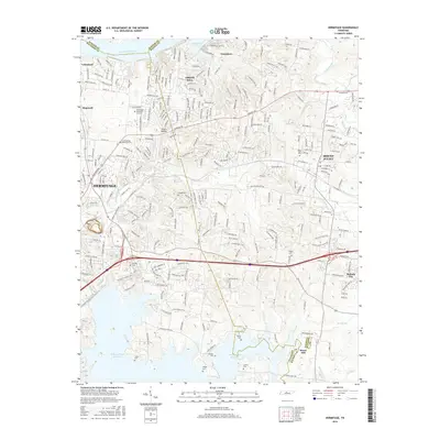
2016 Map of Hermitage
USGS Topo · Published 2016About this map
Hermitage and Mount Juliet anchor this suburban landscape east of Nashville, where residential growth meets the jagged southern shoreline of the J Percy Priest Reservoir. This area preserves several significant family and historical burial grounds, including the Confederate Memorial Cem and Fuqua Cem near the water's edge. The terrain is defined by the winding paths of Stoners Creek and the Cumberland River, which forms the northern boundary at Langford Cove. Development follows established corridors like Central Pike and Stewarts Ferry Pike, connecting smaller settlements like Belinda City and Green Hill. A complex network of drainage, including Vivrett Cr and Suggs Creek, illustrates the local topography before it reaches the massive reservoir system created by mid-century damming.
Find a feature on this map
39 named features on this map. Tap any name to fly to it.
Don’t see what you’re looking for? This feature index may not catch every label — zoom into the map to look around manually.
Map Details
Editions of this 2016 Hermitage Map
This is the sole edition of this map. No revisions or reprints were ever made.
Other maps of this area

1903 · Nashville
USGS Topo · 1:125,000

1932 · Hermitage
USGS Topo · 1:62,500

1942 · Gallatin
USGS Topo · 1:100,000

1942 · Lebanon
USGS Topo · 1:100,000

1951 · Martha
USGS Topo · 1:24,000

1952 · Goodlettsville
USGS Topo · 1:24,000

1952 · Hendersonville
USGS Topo · 1:24,000

1952 · Hermitage
USGS Topo · 1:24,000

1952 · La Vergne
USGS Topo · 1:24,000

1952 · Nashville East
USGS Topo · 1:24,000