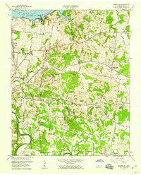
1957 Map of Hermitage
USGS Topo · Published 1959About this map
The Hermitage, the historic estate of Andrew Jackson, serves as a focal point for this mid-century survey of the landscape northeast of Nashville. The area is transitioning from its agrarian roots, visible in the network of family cemeteries like Hays Cem and Wright Cem, into a more developed suburban and recreational corridor. The northern boundary is defined by the recently formed Old Hickory Lake on the Cumberland River, showing the Reservation Boundary and the new shoreline that reshaped local topography.
Find a feature on this map
50 named features on this map. Tap any name to fly to it.
Don’t see what you’re looking for? This feature index may not catch every label — zoom into the map to look around manually.
Map Details
Editions of this 1957 Hermitage Map
This is the sole edition of this map. No revisions or reprints were ever made.
Other maps of this area

1903 · Nashville
USGS Topo · 1:125,000

1932 · Hermitage
USGS Topo · 1:62,500

1942 · Gallatin
USGS Topo · 1:100,000

1942 · Lebanon
USGS Topo · 1:100,000

1951 · Martha
USGS Topo · 1:24,000

1952 · Goodlettsville
USGS Topo · 1:24,000

1952 · Hendersonville
USGS Topo · 1:24,000

1952 · Hermitage
USGS Topo · 1:24,000

1952 · La Vergne
USGS Topo · 1:24,000

1952 · Nashville East
USGS Topo · 1:24,000