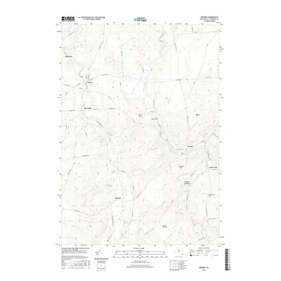
2016 Map of Hermon
USGS Topo · Published 2016About this map
Hermon and Russell serve as the primary anchors of this Saint Lawrence County landscape, where the winding course of the Grass River dictates much of the area's geography. The river passes through notable points like Jacksons Falls and the sharp turn at Devils Elbow, flowing past Earl Island as it moves toward the southeast. The settlement pattern is defined by several small communities and crossroads such as Stellaville, Marshville, and Stalbird, connected by a network of county roads including the Hermon-Pyrites Rd and Pestle Street Rd.
Find a feature on this map
73 named features on this map. Tap any name to fly to it.
Don’t see what you’re looking for? This feature index may not catch every label — zoom into the map to look around manually.
Map Details
Editions of this 2016 Hermon Map
This is the sole edition of this map. No revisions or reprints were ever made.
Other maps of this area

1904 · Ogdensburg
USGS Topo · 1:62,500

1905 · Ogdensburg
USGS Topo · 1:62,500

1910 · Canton
USGS Topo · 1:62,500

1911 · Canton
USGS Topo · 1:62,500

1915 · Gouverneur
USGS Topo · 1:62,500

1915 · Russell
USGS Topo · 1:62,500

1918 · Russell
USGS Topo · 1:62,500

1937 · Gouverneur
USGS Topo · 1:62,500

1943 · Rensselaer Falls
USGS Topo · 1:31,680
1944 · Canton
USGS Topo · 1:62,500