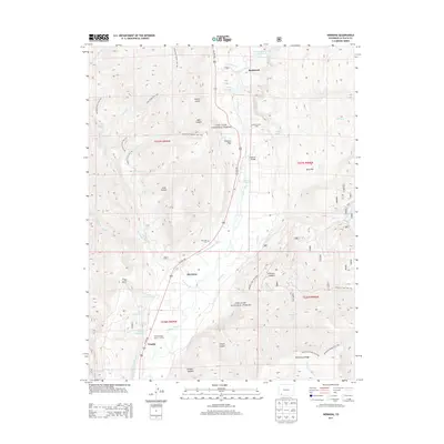
2013 Map of Hermosa
USGS Topo · Published 2013About this map
Rockwood and the narrow valley of the Animas River define this 2013 topographic landscape in La Plata County. The map documents a corridor of thermal activity and early irrigation, featuring several geothermal landmarks including Pinkerton Hot Springs, Tripp Hot Springs, and Trimble Hot Springs. These natural features, along with the Animas Valley Consolidated Ditch and Reid Ditch, illustrate the historical importance of water management in the region's development. Settlement is clustered along the Us HWY 550 corridor at Hermosa and Trimble, where the Hermosa Cem serves as a point of interest for local genealogists. The terrain rises sharply away from the river valley toward the heights of Missionary Ridge and the forested reaches of the San Juan National Forest, traversed by established routes like the Pinkerton Flagstaff Trail 522.
Find a feature on this map
56 named features on this map. Tap any name to fly to it.
Don’t see what you’re looking for? This feature index may not catch every label — zoom into the map to look around manually.
Map Details
Editions of this 2013 Hermosa Map
This is the sole edition of this map. No revisions or reprints were ever made.
Other maps of this area

1898 · Durango
USGS Topo · 1:62,500

1898 · Engineer Mountain
USGS Topo · 1:62,500

1900 · Engineer Mountain
USGS Topo · 1:62,500

1900 · Needle Mountains
USGS Topo · 1:62,500

1902 · Needle Mountains
USGS Topo · 1:62,500

1907 · Durango
USGS Topo · 1:62,500

1908 · Engineer Mountain
USGS Topo · 1:62,500

1908 · Ignacio
USGS Topo · 1:125,000

1908 · Durango
USGS Topo · 1:62,500

1924 · Ignacio
USGS Topo · 1:125,000