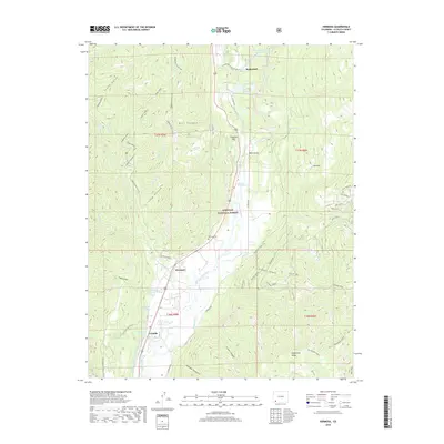
2019 Map of Hermosa
USGS Topo · Published 2019About this map
Hermosa and the surrounding high-country landscape of the San Juan National Forest are defined by the sharp descent from peaks into the Animas River valley. This 2019 survey captures the developed corridor along the river, including the historic proximity of Rockwood and Trimble. The valley floor is crisscrossed by irrigation systems like the Animas Valley Consolidated Ditch and Reid Ditch, essential infrastructure for the agricultural pockets of this mountainous region. Higher elevations are marked by rugged drainages such as Stony Gulch and Bell Canyon, alongside landmarks like Pinkerton Hot Springs. The map provides excellent local detail for genealogists, showing the Hermosa Cem and numerous named water features like Mitchell Lakes and Warner Reservoir Number 5. The eastern edge is dominated by the steep ascent to Missionary Ridge, separating the river valley from the drainage networks of Stevens Cr.
Find a feature on this map
73 named features on this map. Tap any name to fly to it.
Don’t see what you’re looking for? This feature index may not catch every label — zoom into the map to look around manually.
Map Details
Editions of this 2019 Hermosa Map
This is the sole edition of this map. No revisions or reprints were ever made.
Other maps of this area

1898 · Durango
USGS Topo · 1:62,500

1898 · Engineer Mountain
USGS Topo · 1:62,500

1900 · Engineer Mountain
USGS Topo · 1:62,500

1900 · Needle Mountains
USGS Topo · 1:62,500

1902 · Needle Mountains
USGS Topo · 1:62,500

1907 · Durango
USGS Topo · 1:62,500

1908 · Engineer Mountain
USGS Topo · 1:62,500

1908 · Ignacio
USGS Topo · 1:125,000

1908 · Durango
USGS Topo · 1:62,500

1924 · Ignacio
USGS Topo · 1:125,000