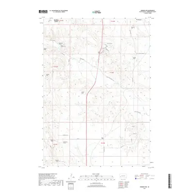
2017 Map of Hermosa NW
USGS Topo · Published 2017About this map
Rapid City boundaries reach into the northern portion of this South Dakota landscape, where the urban edge meets the complex drainages of the Black Hills foothills. The terrain is defined by a network of named canyons and draws, including Moonshine Canyon, Prairie Chicken Draw, and Walt Smith Canyon, illustrating a topography shaped by intermittent water flow. Road networks such as Old Folsom Rd and Daughenbaugh Rd connect scattered points of interest like the small settlement of Ajax and the prominent Potato Butte. These landmarks, along with Brennan Hill and Gobbler Knob, provide clear navigational anchors across a region where ranching and rural residential development intersect with the seasonal courses of Spring Creek and Dry Creek.
Find a feature on this map
44 named features on this map. Tap any name to fly to it.
Don’t see what you’re looking for? This feature index may not catch every label — zoom into the map to look around manually.
Map Details
Editions of this 2017 Hermosa NW Map
This is the sole edition of this map. No revisions or reprints were ever made.
Other maps of this area

1893 · Rapid
USGS Topo · 1:125,000

1894 · Hermosa
USGS Topo · 1:125,000

1898 · Rapid
USGS Topo · 1:125,000

1901 · Hermosa
USGS Topo · 1:125,000

1903 · Rapid
USGS Topo · 1:125,000

1953 · Boxelder
USGS Topo · 1:24,000

1953 · Hermosa NW
USGS Topo · 1:24,000

1953 · Rapid City East
USGS Topo · 1:24,000

1953 · Hermosa
USGS Topo · 1:24,000

1953 · Rapid City West
USGS Topo · 1:24,000