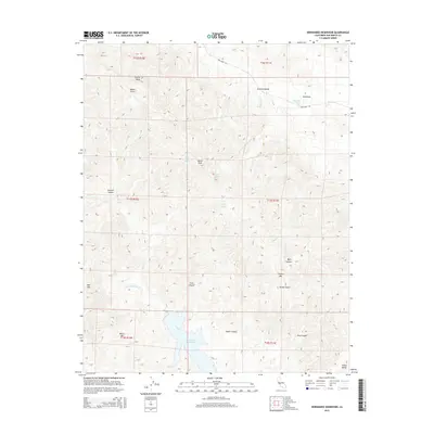
2015 Map of Hernandez Reservoir
USGS Topo · Published 2015About this map
Hernandez Reservoir dominates the southern landscape of this 2015 survey, serving as a primary water source along the San Benito River in the high country of the Diablo Range. The terrain is defined by a series of significant canyons and peaks, including Black Mtn, Tucker Mtn, and the distinctive Castle Rock to the north. These landforms create a complex network of drainages such as Byles Canyon and Post Canyon.
Find a feature on this map
33 named features on this map. Tap any name to fly to it.
Don’t see what you’re looking for? This feature index may not catch every label — zoom into the map to look around manually.
Map Details
Editions of this 2015 Hernandez Reservoir Map
This is the sole edition of this map. No revisions or reprints were ever made.
Other maps of this area

1913 · Panoche
USGS Topo · 1:125,000

1915 · Priest Valley
USGS Topo · 1:125,000

1943 · New Idria
USGS Topo · 1:62,500

1943 · Hernandez Valley
USGS Topo · 1:62,500

1944 · Hernandez Valley
USGS Topo · 1:62,500

1944 · Panoche Valley
USGS Topo · 1:62,500

1948 · Santa Cruz
USGS Topo · 1:250,000

1955 · Santa Cruz
USGS Topo · 1:250,000
1956 · New Idria
USGS Topo · 1:62,500
1956 · Tumey Hills
USGS Topo · 1:24,000