
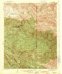
1943 Map of New Idria
USGS Topo · Published 1943About this map
Mining operations dominate the landscape of the Diablo Range during the early 1940s, centered around the significant mercury production site at New Idria Idria PO. This survey, conducted just as the demand for quicksilver surged during the war years, reveals an intensive network of claims including the Spanish Mine, Aurora Mine, and Gem Mine. The terrain is characterized by high peaks such as San Benito Mtn and Santa Rita Pk, which overlook the headwaters of the San Benito River and the rugged Joaquin Rocks on the eastern flank. Isolated agricultural outposts like the John Ashurst Ranch and Jones Ranch provide a sparse human footprint in a region defined by its geological wealth. The intricate contours trace the deep incisions of Larious Canyon and Arroyo Cantua, illustrating a landscape where industrial extraction and cattle ranching coexisted along the remote county lines of San Benito and Fresno.
Find a feature on this map
54 named features on this map. Tap any name to fly to it.
Don’t see what you’re looking for? This feature index may not catch every label — zoom into the map to look around manually.
Map Details
Editions of this 1943 New Idria Map
2 editions found
Other maps of this area

1912 · Coalinga
USGS Topo · 1:125,000

1913 · Panoche
USGS Topo · 1:125,000

1915 · Priest Valley
USGS Topo · 1:125,000

1923 · Levis
USGS Topo · 1:31,680

1923 · Monocline Ridge
USGS Topo · 1:31,680

1941 · Priest Valley
USGS Topo · 1:62,500

1941 · San Ardo
USGS Topo · 1:62,500

1943 · Joaquin Rocks
USGS Topo · 1:62,500

1943 · San Ardo
USGS Topo · 1:62,500

1943 · Hernandez Valley
USGS Topo · 1:62,500