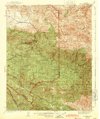
1943 Map of New Idria
USGS Topo · Published 1943About this map
The mercury-rich mining district around New Idria Idria PO dominates this 1943 survey, conducted just as the nation's wartime industrial demand was peaking. The map meticulously documents the rugged intersection of the San Benito and Monterey county lines, showcasing a landscape defined by isolated ranches and numerous active or significant mineral claims. Among these are the Spanish Mine, the Picacho Mine, and the Aurora Mine, reflecting the area's importance as a premier source of quicksilver. The terrain is marked by significant peaks such as San Benito Mtn and Santa Rita Pk, which overlook the headwaters of the San Benito River and Clear Creek. The inclusion of the John Ashurst Ranch and Jones Ranch provides a window into the pastoral activities that persisted alongside the industrial extraction of the Tumey and Griswold Hills.
Find a feature on this map
44 named features on this map. Tap any name to fly to it.
Don’t see what you’re looking for? This feature index may not catch every label — zoom into the map to look around manually.
Map Details
Editions of this 1943 New Idria Map
2 editions found
Other maps of this area

1912 · Coalinga
USGS Topo · 1:125,000

1913 · Panoche
USGS Topo · 1:125,000

1915 · Priest Valley
USGS Topo · 1:125,000

1923 · Levis
USGS Topo · 1:31,680

1923 · Monocline Ridge
USGS Topo · 1:31,680

1941 · Priest Valley
USGS Topo · 1:62,500

1941 · San Ardo
USGS Topo · 1:62,500

1943 · New Idria
USGS Topo · 1:62,500

1943 · Joaquin Rocks
USGS Topo · 1:62,500

1943 · San Ardo
USGS Topo · 1:62,500