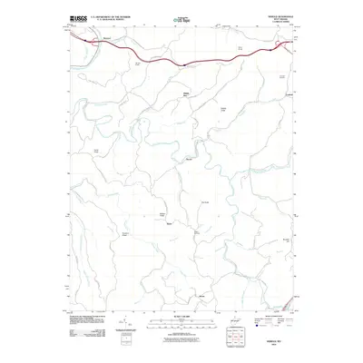
2010 Map of Herold
USGS Topo · Published 2010About this map
Herold and the surrounding Braxton County countryside are defined by a complex network of ridges and watercourses as they appeared in 2010. The Birch River snakes through the center of the quadrangle, joined by tributaries like Little Birch River, Strange Creek, and Wolf Pen Run. These waterways carved the deep valleys that separate prominent high points such as James Knob, Coon Knob, and Davis Knob. Settlement patterns follow the winding roads through these gaps, connecting small communities like Canfield, Middle Run, and Morris.
Find a feature on this map
70 named features on this map. Tap any name to fly to it.
Don’t see what you’re looking for? This feature index may not catch every label — zoom into the map to look around manually.
Map Details
Editions of this 2010 Herold Map
This is the sole edition of this map. No revisions or reprints were ever made.
Other maps of this area

1889 · Nicholas
USGS Topo · 1:125,000

1891 · Nicholas
USGS Topo · 1:125,000

1893 · Sutton
USGS Topo · 1:125,000

1901 · Nicholas
USGS Topo · 1:125,000

1908 · Gassaway
USGS Topo · 1:48,000

1908 · Sutton
USGS Topo · 1:48,000

1910 · Sutton Special
USGS Topo · 1:62,500

1910 · Gassaway
USGS Topo · 1:62,500

1913 · Summersville
USGS Topo · 1:48,000

1915 · Cowen
USGS Topo · 1:48,000