2012 Map of Herreid NE
USGS Topo · Published 2012About this map
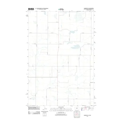
Neuwsma Lake sits as the central geographic feature of this prairie landscape along the border of Campbell County and the North Dakota state line. This 2012 survey documents a grid of section-line roads, such as 100th St SE and 16th Ave SE, which define the agricultural character of the region. The map captures a moment in the early 21st century where the landscape remains sparsely populated, dominated by wide-open drainage patterns and intermittent wetlands typical of the northern Great Plains. Settlement is primarily reflected through the local road network, including corridors like Bridgewater Pl, which connect isolated homesteads and farmsteads across the undulating terrain. Genealogists and local historians can use this detailed layout to pinpoint specific land tracts and the evolving infrastructure of this rural borderland.
Find a feature on this map
19 named features on this map. Tap any name to fly to it.
Don’t see what you’re looking for? This feature index may not catch every label — zoom into the map to look around manually.
Map Details
Editions of this 2012 Herreid NE Map
This is the sole edition of this map. No revisions or reprints were ever made.
Other maps of this area

1953 · Jamestown
USGS Topo · 1:250,000

1953 · McIntosh
USGS Topo · 1:250,000

1954 · Aberdeen
USGS Topo · 1:250,000

1954 · Bismarck
USGS Topo · 1:250,000

1956 · Aberdeen
USGS Topo · 1:250,000

1956 · Jamestown
USGS Topo · 1:250,000

1958 · Bismarck
USGS Topo · 1:250,000

1958 · McIntosh
USGS Topo · 1:250,000

1965 · Herreid NW
USGS Topo · 1:24,000

1965 · Herreid SW
USGS Topo · 1:24,000