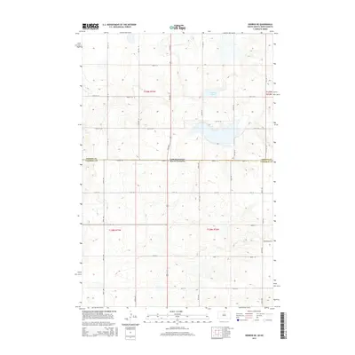
2015 Map of Herreid NE
USGS Topo · Published 2015About this map
Neuwsma Lake sits at the heart of this prairie landscape, straddling the northern boundary where the Dakotas meet. This 2015 survey captures the rural character of the borderlands between Emmons County, North Dakota, and Campbell County, South Dakota. The terrain is defined by a strictly organized grid of agricultural roads, including 102nd St SE which follows the state line, and north-south connectors like 15th Ave S and 307th Ave. The map illustrates a region dedicated to expansive farming and ranching, where isolated corridors like Bridgewater Pl provide access to remote homesteads and section lands. The natural hydrology of the lake and its surrounding depressions provides a stark contrast to the precise geometric lines of the Public Land Survey System that govern the placement of every road and boundary in the area.
Find a feature on this map
27 named features on this map. Tap any name to fly to it.
Don’t see what you’re looking for? This feature index may not catch every label — zoom into the map to look around manually.
Map Details
Editions of this 2015 Herreid NE Map
This is the sole edition of this map. No revisions or reprints were ever made.
Other maps of this area

1953 · Jamestown
USGS Topo · 1:250,000

1953 · McIntosh
USGS Topo · 1:250,000

1954 · Aberdeen
USGS Topo · 1:250,000

1954 · Bismarck
USGS Topo · 1:250,000

1956 · Aberdeen
USGS Topo · 1:250,000

1956 · Jamestown
USGS Topo · 1:250,000

1958 · Bismarck
USGS Topo · 1:250,000

1958 · McIntosh
USGS Topo · 1:250,000

1965 · Herreid NW
USGS Topo · 1:24,000

1965 · Herreid SW
USGS Topo · 1:24,000