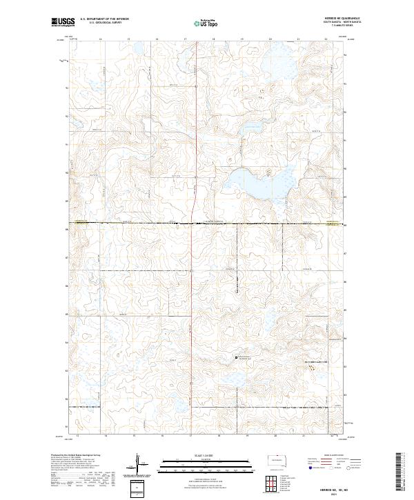
2021 Map of Herreid NE
USGS Topo · Published 2021About this map
Holland Pioneer - Van Raalte Cem stands as a focal point for local heritage on the border of Campbell County, South Dakota, and Emmons County, North Dakota. This section of the Great Plains is defined by a grid of rural section lines like Zeeland Rd and 306th Ave, which connect the scattered farmsteads of the region. The landscape is dotted with numerous small wetlands and basins, most notably Nieuwsma Lake in the northeastern portion of the quadrangle. The topography reflects the transition between the Dakotas, where township lines like t128n r76w and t129n r75w organize a terrain of subtle rises and depressions used primarily for agriculture and grazing.
Find a feature on this map
29 named features on this map. Tap any name to fly to it.
Don’t see what you’re looking for? This feature index may not catch every label — zoom into the map to look around manually.
Map Details
Editions of this 2021 Herreid NE Map
This is the sole edition of this map. No revisions or reprints were ever made.
Other maps of this area

1953 · Jamestown
USGS Topo · 1:250,000

1953 · McIntosh
USGS Topo · 1:250,000

1954 · Aberdeen
USGS Topo · 1:250,000

1954 · Bismarck
USGS Topo · 1:250,000

1956 · Aberdeen
USGS Topo · 1:250,000

1956 · Jamestown
USGS Topo · 1:250,000

1958 · Bismarck
USGS Topo · 1:250,000

1958 · McIntosh
USGS Topo · 1:250,000

1965 · Herreid NW
USGS Topo · 1:24,000

1965 · Herreid SW
USGS Topo · 1:24,000