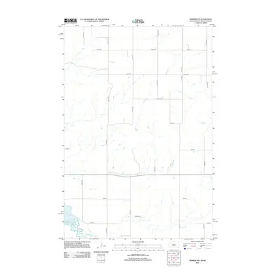
2012 Map of Herreid NW
USGS Topo · Published 2012About this map
Lake Pocasse defines the southwestern corner of this landscape, where the waters meet a strictly organized grid of rural section lines. This survey captures a pocket of Campbell County where the early 21st-century topography remains dominated by agricultural commerce and local family connections. A network of numbered routes, such as 100th St SE and 10th Ave SE, crisscrosses the prairie, marking the boundaries of farms and homesteads. Local naming is evident in features like Reierson Pl, which suggests the enduring presence of family lineages in this part of the state. The map illustrates the intersection of natural drainage patterns with a human-imposed geometry, typical of the Dakotas' high-plains development.
Find a feature on this map
22 named features on this map. Tap any name to fly to it.
Don’t see what you’re looking for? This feature index may not catch every label — zoom into the map to look around manually.
Map Details
Editions of this 2012 Herreid NW Map
This is the sole edition of this map. No revisions or reprints were ever made.
Other maps of this area

1953 · McIntosh
USGS Topo · 1:250,000

1954 · Bismarck
USGS Topo · 1:250,000

1958 · Bismarck
USGS Topo · 1:250,000

1958 · McIntosh
USGS Topo · 1:250,000

1965 · Herreid NW
USGS Topo · 1:24,000

1965 · Herreid SW
USGS Topo · 1:24,000

1965 · Herreid NE
USGS Topo · 1:24,000

1965 · Herreid
USGS Topo · 1:24,000

1965 · Pollock SE
USGS Topo · 1:24,000

1965 · Pollock
USGS Topo · 1:24,000