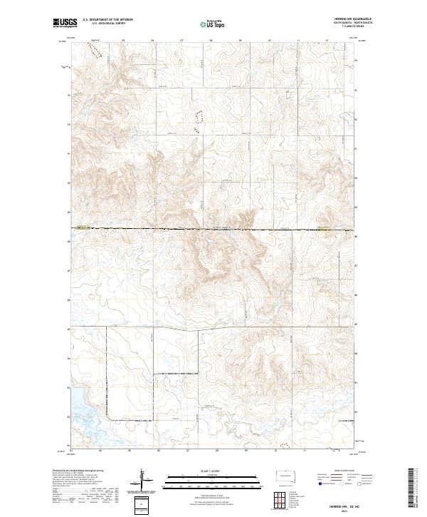
2021 Map of Herreid NW
USGS Topo · Published 2021About this map
Emmons County, North Dakota, meets Campbell County, South Dakota, along a landscape defined by the drainage of Spring Creek into the northern reaches of Lake Pocasse. This 2021 survey illustrates a sparse prairie grid where section lines are traced by a network of gravel and local roads, including 7th Ave SE and 302nd Ave. The terrain transitions from the higher plateaus in the north toward the marshy lowlands surrounding the lake in the southwest corner. Local land use is indicated by markers like Reierson Pl, situated just north of the creek. The map provides a contemporary look at this border region, documenting the hydrological features and administrative boundaries that have shaped the rural development of both states.
Find a feature on this map
27 named features on this map. Tap any name to fly to it.
Don’t see what you’re looking for? This feature index may not catch every label — zoom into the map to look around manually.
Map Details
Editions of this 2021 Herreid NW Map
This is the sole edition of this map. No revisions or reprints were ever made.
Other maps of this area

1953 · McIntosh
USGS Topo · 1:250,000

1954 · Bismarck
USGS Topo · 1:250,000

1958 · Bismarck
USGS Topo · 1:250,000

1958 · McIntosh
USGS Topo · 1:250,000

1965 · Herreid NW
USGS Topo · 1:24,000

1965 · Herreid SW
USGS Topo · 1:24,000

1965 · Herreid NE
USGS Topo · 1:24,000

1965 · Herreid
USGS Topo · 1:24,000

1965 · Pollock SE
USGS Topo · 1:24,000

1965 · Pollock
USGS Topo · 1:24,000