
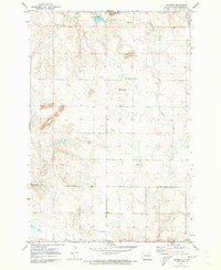
1965 Map of Herreid NW
USGS Topo · Published 1966About this map
Oahe Reservoir and the adjacent Lake Pocasse dominate the southwestern corner of this mid-1960s landscape, reflecting the significant hydrological changes in the Missouri River basin. The terrain is defined by the sharp jurisdictional boundary between Emmons and Campbell counties, which also serves as the state line between North Dakota and South Dakota. Rural life is anchored by the Spring Creek Cem, situated near the winding path of Spring Creek as it flows toward the reservoir. Transportation and commerce are represented by the tracks of the Soo Line railroad, which cuts through the Missouri River hills. The map illustrates a transitional period of land use where established agricultural boundaries meet the newly formed shorelines of massive water management projects.
Find a feature on this map
7 named features on this map. Tap any name to fly to it.
Don’t see what you’re looking for? This feature index may not catch every label — zoom into the map to look around manually.
Map Details
Editions of this 1965 Herreid NW Map
This is the sole edition of this map. No revisions or reprints were ever made.
Other maps of this area

1953 · McIntosh
USGS Topo · 1:250,000

1954 · Bismarck
USGS Topo · 1:250,000

1958 · Bismarck
USGS Topo · 1:250,000

1958 · McIntosh
USGS Topo · 1:250,000

1965 · Herreid SW
USGS Topo · 1:24,000

1965 · Herreid NE
USGS Topo · 1:24,000

1965 · Herreid
USGS Topo · 1:24,000

1965 · Pollock SE
USGS Topo · 1:24,000

1965 · Pollock
USGS Topo · 1:24,000
1971 · Grassna
USGS Topo · 1:24,000