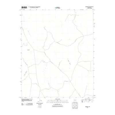
2010 Map of Herrera
USGS Topo · Published 2010About this map
Herrera anchors this high-desert landscape in the Eastern Navajo Agency, situated within a complex network of transportation and topography. The settlement is positioned along several branches of Indian Service Rd, which crisscross the territory to connect remote homesteads and grazing lands. The terrain is defined by prominent landforms including the elongated La Mesa Quebrada and the distinct elevation of La Mesita Blanca. Water features are sparse, with the ephemeral drainage of Cañada del Ojo providing one of the few named hydrological markers in the area. Portions of the Laguna Indian Res extend into this quadrangle, reflecting the intricate jurisdictional boundaries of tribal lands in New Mexico during the early twenty-first century.
Find a feature on this map
6 named features on this map. Tap any name to fly to it.
Don’t see what you’re looking for? This feature index may not catch every label — zoom into the map to look around manually.
Map Details
Editions of this 2010 Herrera Map
This is the sole edition of this map. No revisions or reprints were ever made.
Other maps of this area

1883 · Mt. Taylor
USGS Topo · 1:250,000

1886 · Mt. Taylor
USGS Topo · 1:250,000

1888 · Bernalillo
USGS Topo · 1:125,000

1889 · Albuquerque
USGS Topo · 1:125,000

1892 · Mt. Taylor
USGS Topo · 1:250,000

1893 · Albuquerque
USGS Topo · 1:125,000

1899 · Mt. Taylor
USGS Topo · 1:250,000

1954 · Herrera
USGS Topo · 1:24,000

1954 · Sky Village
USGS Topo · 1:24,000

1954 · Canoncito School
USGS Topo · 1:24,000