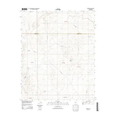
2013 Map of Herrera
USGS Topo · Published 2013About this map
Herrera stands as a primary point of reference in this landscape at the intersection of the Sandoval Co Bernalillo Co line. The terrain is defined by dramatic mesas, most notably La Mesita Blanca and La Mesa Quebrada, which rise above the surrounding plateaus. This 2013 survey illustrates the modern configuration of the Laguna Indian Res, which occupies the northern reaches of the quadrangle. A network of arterial routes, including the Indian Service Rd and Rte 7041, weave through the townships, indicating the importance of established transport corridors in navigating these high-elevation landforms. The presence of section-line roads and specialized routes like 7041 Ter reflects the ongoing coordination between tribal and county jurisdictions in this portion of New Mexico.
Find a feature on this map
13 named features on this map. Tap any name to fly to it.
Don’t see what you’re looking for? This feature index may not catch every label — zoom into the map to look around manually.
Map Details
Editions of this 2013 Herrera Map
This is the sole edition of this map. No revisions or reprints were ever made.
Other maps of this area

1883 · Mt. Taylor
USGS Topo · 1:250,000

1886 · Mt. Taylor
USGS Topo · 1:250,000

1888 · Bernalillo
USGS Topo · 1:125,000

1889 · Albuquerque
USGS Topo · 1:125,000

1892 · Mt. Taylor
USGS Topo · 1:250,000

1893 · Albuquerque
USGS Topo · 1:125,000

1899 · Mt. Taylor
USGS Topo · 1:250,000

1954 · Herrera
USGS Topo · 1:24,000

1954 · Sky Village
USGS Topo · 1:24,000

1954 · Canoncito School
USGS Topo · 1:24,000