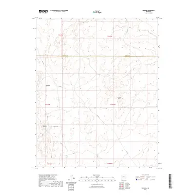
2023 Map of Herrera
USGS Topo · Published 2023About this map
Herrera stands as the primary settlement in this high-desert landscape, located just west of the Rio Puerco. The terrain is defined by distinct geologic formations, including the prominent La Mesa Quebrada to the southwest and the isolated rise of La Mesita Blanca in the east. This 2023 survey by the U.S. Geological Survey illustrates a modern infrastructure of service roads and designated trails, such as Indian Svc Rte 48 and Tribal Rd N7077, which provide access through the complex topography. The map spans the boundary between Sandoval County and Bernalillo County, detailing the drainage patterns and elevation contours that have shaped land use in this part of New Mexico.
Find a feature on this map
20 named features on this map. Tap any name to fly to it.
Don’t see what you’re looking for? This feature index may not catch every label — zoom into the map to look around manually.
Map Details
Editions of this 2023 Herrera Map
This is the sole edition of this map. No revisions or reprints were ever made.
Other maps of this area

1883 · Mt. Taylor
USGS Topo · 1:250,000

1886 · Mt. Taylor
USGS Topo · 1:250,000

1888 · Bernalillo
USGS Topo · 1:125,000

1889 · Albuquerque
USGS Topo · 1:125,000

1892 · Mt. Taylor
USGS Topo · 1:250,000

1893 · Albuquerque
USGS Topo · 1:125,000

1899 · Mt. Taylor
USGS Topo · 1:250,000

1954 · Herrera
USGS Topo · 1:24,000

1954 · Sky Village
USGS Topo · 1:24,000

1954 · Canoncito School
USGS Topo · 1:24,000