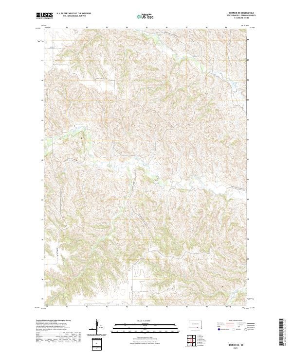
2021 Map of Herrick NE
USGS Topo · Published 2021About this map
N Fork Whetstone Cr and S Fork Whetstone Cr carve through this Gregory County landscape, defining the local drainage patterns south of the Missouri River. The land is organized by a grid of township roads and rural routes, reflecting the agricultural division of South Dakota's prairie. Significant corridors like the Whetstone Township Hwy and Turgeon Township Hwy connect the high ground between creek valleys. Historical transit is noted by the presence of the Old 1806 Rd in the northeastern corner, a route namesake for the Lewis and Clark era. Other smaller drainages such as Sand Cr, Petes Cr, and Burnt Rock Cr further fragment the terrain, while local names like Turkey Vulcher Rd provide specific geographical markers for researchers of the area's modern rural character.
Find a feature on this map
19 named features on this map. Tap any name to fly to it.
Don’t see what you’re looking for? This feature index may not catch every label — zoom into the map to look around manually.
Map Details
Editions of this 2021 Herrick NE Map
This is the sole edition of this map. No revisions or reprints were ever made.
Other maps of this area

1955 · Mitchell
USGS Topo · 1:250,000

1959 · Mitchell
USGS Topo · 1:250,000

1964 · Herrick NW
USGS Topo · 1:24,000

1964 · Herrick NE
USGS Topo · 1:24,000

1964 · St. Charles
USGS Topo · 1:24,000

1964 · Whetstone Bay
USGS Topo · 1:24,000
1964 · Herrick
USGS Topo · 1:24,000
1964 · Bonesteel
USGS Topo · 1:24,000

1971 · Lucas
USGS Topo · 1:24,000

1971 · Lucas SE
USGS Topo · 1:24,000