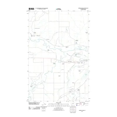
2011 Map of Herron Park
USGS Topo · Published 2011About this map
The Milk River meanders through the northern portion of this Hill County landscape, cutting through the Milk River Badlands and receiving drainage from numerous coulees such as Rattlesnake Coulee and Neal Coulee. This 2011 survey reveals a mix of agricultural ranching and modern infrastructure, centered around the community of Beaver Creek and the railroad-oriented Pacific Junction. The map captures the specialized land use of the region, from the industrial Tiger Ridge Gas Field to the recreational facilities at Beaver Creek Golf Course and Evergreen Campground.
Find a feature on this map
57 named features on this map. Tap any name to fly to it.
Don’t see what you’re looking for? This feature index may not catch every label — zoom into the map to look around manually.
Map Details
Editions of this 2011 Herron Park Map
This is the sole edition of this map. No revisions or reprints were ever made.
Other maps of this area

1904 · Havre
USGS Topo · 1:62,500

1904 · Assinniboine
USGS Topo · 1:62,500

1912 · Thibedeau Lake
USGS Topo · 1:125,000

1953 · Havre
USGS Topo · 1:250,000

1957 · Havre
USGS Topo · 1:250,000

1958 · Havre
USGS Topo · 1:250,000

1959 · Laredo
USGS Topo · 1:62,500

1959 · Shambo
USGS Topo · 1:62,500

1964 · Havre NW
USGS Topo · 1:24,000

1964 · Havre
USGS Topo · 1:24,000