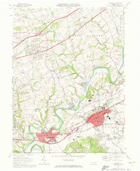
1969 Map of Hershey
USGS Topo · Published 1972About this map
The town of Hershey and its surrounding townships show a landscape deeply shaped by the chocolate industry and institutional growth in the late 1960s. Along the Reading railroad corridor, the map details the core of the community, featuring the Hershey Park complex, the Hershey Museum, and the expansive Stadium. The emergence of the Hershey Medical Center and the State Police Academy highlights the area's transition into a regional hub for healthcare and education.
Find a feature on this map
62 named features on this map. Tap any name to fly to it.
Don’t see what you’re looking for? This feature index may not catch every label — zoom into the map to look around manually.
Map Details
Editions of this 1969 Hershey Map
4 editions found

Other maps of this area

1892 · Hummelstown
USGS Topo · 1:62,500

1892 · Harrisburg
USGS Topo · 1:62,500

1899 · Harrisburg
USGS Topo · 1:62,500

1906 · New Cumberland
USGS Topo · 1:62,500

1908 · Middletown
USGS Topo · 1:62,500

1924 · Hummelstown
USGS Topo · 1:62,500

1924 · Harrisburg
USGS Topo · 1:62,500

1943 · New Cumberland
USGS Topo · 1:62,500

1943 · Middletown
USGS Topo · 1:62,500

1943 · Harrisburg
USGS Topo · 1:62,500
Featured Places
- Hershey, Derry Township
- Rutherford, Swatara Township
- Skyline View, West Hanover Township
- Hummelstown, PA
- East Hanover Township, PA