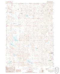
1986 Map of Hessey Lake
USGS Topo · Published 1986About this map
Crescent Lake National Wildlife Refuge anchors the southern portion of this mid-1980s Nebraska survey, revealing a landscape defined by an intricate network of shallow basins and ponds. In this corner of Garden County, the terrain is shaped by the characteristic sandhills environment, where isolated ranching outposts like Young Ranch and Pawlet Ranch represent the primary human imprint. The map shows how these operations integrated into the landscape, including a remote Landing Strip situated between Webster Lake and Wolf Lake.
Find a feature on this map
18 named features on this map. Tap any name to fly to it.
Don’t see what you’re looking for? This feature index may not catch every label — zoom into the map to look around manually.
Map Details
Editions of this 1986 Hessey Lake Map
This is the sole edition of this map. No revisions or reprints were ever made.
Other maps of this area

1949 · Mumper
USGS Topo · 1:62,500

1949 · Rackett
USGS Topo · 1:62,500

1950 · Crescent Lake
USGS Topo · 1:62,500

1950 · Longfellow Lake
USGS Topo · 1:62,500

1951 · Rackett
USGS Topo · 1:62,500

1954 · Scottsbluff
USGS Topo · 1:250,000

1958 · Scottsbluff
USGS Topo · 1:250,000

1985 · Crescent Lake
USGS Topo · 1:100,000
1986 · McCarty Lake
USGS Topo · 1:24,000
1986 · Schoonover Lake
USGS Topo · 1:24,000