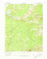
1956 Map of Hetch Hetchy Reservoir
USGS Topo · Published 1973About this map
Hetch Hetchy Reservoir and the surrounding high Sierra wilderness are meticulously documented in this mid-century survey of Yosemite National Park. The map centers on the water-carved granite of the Grand Canyon of the Tuolumne River, tracing the river's path from Muir Gorge through Pate Valley and into the reservoir. This era shows the developed infrastructure of the park before modern expansions, including the footprint of White Wolf and the primitive Old Tioga Road.
Find a feature on this map
84 named features on this map. Tap any name to fly to it.
Don’t see what you’re looking for? This feature index may not catch every label — zoom into the map to look around manually.
Map Details
Editions of this 1956 Hetch Hetchy Reservoir Map
4 editions found

Other maps of this area

1896 · Dardanelles
USGS Topo · 1:125,000

1897 · Yosemite
USGS Topo · 1:125,000

1898 · Dardanelles
USGS Topo · 1:125,000

1900 · Yosemite
USGS Topo · 1:125,000

1901 · Mt. Lyell
USGS Topo · 1:125,000

1903 · Yosemite
USGS Topo · 1:125,000

1909 · Yosemite
USGS Topo · 1:125,000

1909 · Bridgeport
USGS Topo · 1:125,000

1911 · Bridgeport
USGS Topo · 1:125,000

1920 · Bridgeport
USGS Topo · 1:125,000