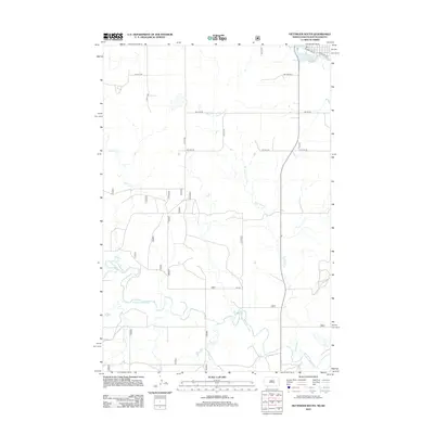
2012 Map of Hettinger South
USGS Topo · Published 2012About this map
Mirror Lake sits at the northern edge of this North Dakota landscape, where the prairie grid of Adams County meets the drainage of the N Fork Grand River. The area is defined by a series of north-south running waterways including Bull Hook Cr, Slick Cr, and Billy Young Cr, which carve subtle paths through the agricultural sections. The map traces the southern outskirts of town along Railroad Ave and Mirror Lake Rd, illustrating the transition from local street networks to more isolated rural routes like Lyle Rd. This survey documents the hydrology of the western Dakota plains, showcasing how small tributaries like Deer Cr contribute to the larger Grand River system within a strictly surveyed section-line road framework.
Find a feature on this map
19 named features on this map. Tap any name to fly to it.
Don’t see what you’re looking for? This feature index may not catch every label — zoom into the map to look around manually.
Map Details
Editions of this 2012 Hettinger South Map
This is the sole edition of this map. No revisions or reprints were ever made.
Other maps of this area

1953 · Dickinson
USGS Topo · 1:250,000

1954 · Lemmon
USGS Topo · 1:250,000

1957 · Dickinson
USGS Topo · 1:250,000

1957 · Lemmon
USGS Topo · 1:250,000

1974 · Hettinger North
USGS Topo · 1:24,000

1974 · Hettinger South
USGS Topo · 1:24,000

1974 · Cow Butte NE
USGS Topo · 1:24,000

1974 · Kid Rich Butte
USGS Topo · 1:24,000

1980 · Mott
USGS Topo · 1:100,000

1983 · Cow Butte SE
USGS Topo · 1:24,000