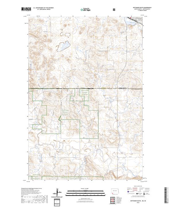
2024 Map of Hettinger South
USGS Topo · Published 2024About this map
Hettinger occupies the northern edge of this high plains landscape, situated along a transportation corridor defined by Railroad Ave and Mirror Lake Ave. Just south of the town center, Mirror Lake provides a central water feature before the terrain transitions into the wide-open prairie of the Grand River National Grassland. The map reveals a complex drainage system where Bull Hook Creek and Slick Creek flow southward to join the North Fork Grand River, which meanders across the state line between Adams County, North Dakota, and Perkins County, South Dakota.
Find a feature on this map
25 named features on this map. Tap any name to fly to it.
Don’t see what you’re looking for? This feature index may not catch every label — zoom into the map to look around manually.
Map Details
Editions of this 2024 Hettinger South Map
This is the sole edition of this map. No revisions or reprints were ever made.
Other maps of this area

1953 · Dickinson
USGS Topo · 1:250,000

1954 · Lemmon
USGS Topo · 1:250,000

1957 · Dickinson
USGS Topo · 1:250,000

1957 · Lemmon
USGS Topo · 1:250,000

1974 · Hettinger North
USGS Topo · 1:24,000

1974 · Hettinger South
USGS Topo · 1:24,000

1974 · Cow Butte NE
USGS Topo · 1:24,000

1974 · Kid Rich Butte
USGS Topo · 1:24,000

1980 · Mott
USGS Topo · 1:100,000

1983 · Cow Butte SE
USGS Topo · 1:24,000