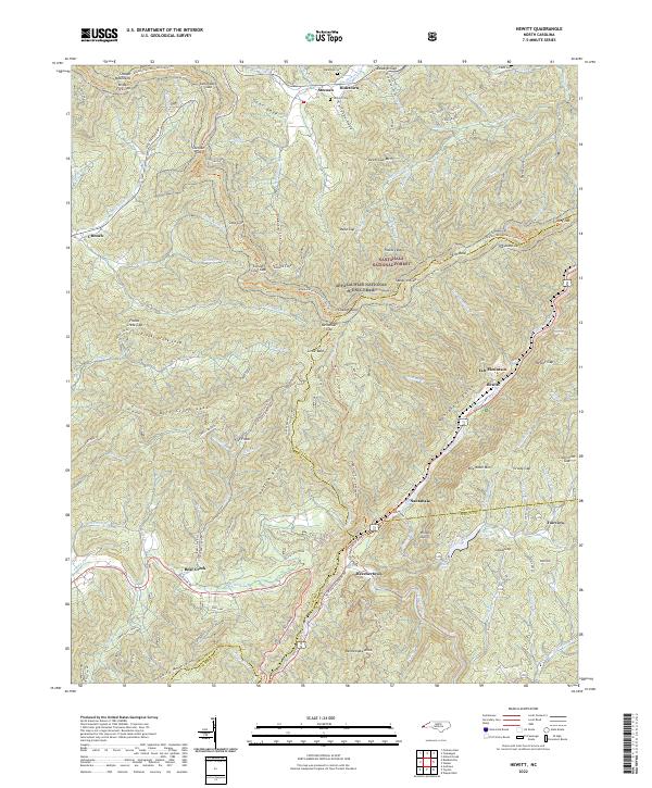
2022 Map of Hewitt
USGS Topo · Published 2022About this map
Stecoah and Hidetown sit at the northern edge of this mountain corridor, where small settlements are tucked into the drainages of the Cheoah Mountains. The landscape is defined by the steep descent into the Nantahala Gorge, a deep topographic feature where the Nantahala River flows alongside the Tululah Railroad and Nantahala George Road. Transportation in this era is constrained by the terrain, with the Appalachian National Scenic Trail traversing high ridges like Cheoah Bald and Swim Bald, while vehicular traffic follows the river valley through Beechertown and Nantahala. Genealogists may find interest in several upland burial sites, including Randolph Cemetery and Jenkins Cemetery. The map also captures the southern reach of Queens Creek Lake and the confluence of numerous mountain branches, such as Sweetwater Creek and Tulula Creek, as they feed into the regional river system.
Find a feature on this map
103 named features on this map. Tap any name to fly to it.
Don’t see what you’re looking for? This feature index may not catch every label — zoom into the map to look around manually.
Map Details
Editions of this 2022 Hewitt Map
This is the sole edition of this map. No revisions or reprints were ever made.
Other maps of this area

1933 · Bushnell
USGS Topo · 1:62,500

1935 · Robbinsville
USGS Topo · 1:24,000

1935 · Fontana
USGS Topo · 1:24,000

1935 · Burningtown Bald
USGS Topo · 1:24,000

1935 · Topton
USGS Topo · 1:24,000

1935 · Wayah Bald
USGS Topo · 1:48,000

1935 · Andrews
USGS Topo · 1:24,000

1936 · Proctor
USGS Topo · 1:24,000

1936 · Wesser
USGS Topo · 1:24,000
1936 · Hewitt
USGS Topo · 1:24,000