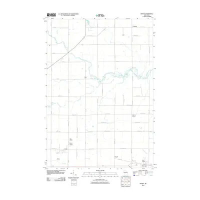
2010 Map of Hewitt
USGS Topo · Published 2010About this map
The Little Eau Pleine River winds through the northern reaches of Wood County in this 2010 topographic record, defining a landscape of agricultural tracts and rural crossroads. The settlement of Hewitt sits in the southwestern corner, situated along a grid of local roads like Yellowstone Dr and N Rockwood Rd. To the east, Auburndale serves as a secondary focal point, surrounded by several historically significant burial grounds including Saint Marys Cemetery and the Auburndale Cemetery.
Find a feature on this map
50 named features on this map. Tap any name to fly to it.
Don’t see what you’re looking for? This feature index may not catch every label — zoom into the map to look around manually.
Map Details
Editions of this 2010 Hewitt Map
This is the sole edition of this map. No revisions or reprints were ever made.
Other maps of this area

1902 · Marathon
USGS Topo · 1:125,000

1953 · Marathon
USGS Topo · 1:48,000

1953 · Stratford
USGS Topo · 1:48,000

1953 · Eau Claire
USGS Topo · 1:250,000

1954 · Marshfield
USGS Topo · 1:62,500

1955 · Green Bay
USGS Topo · 1:250,000

1956 · Milladore
USGS Topo · 1:48,000

1958 · Eau Claire
USGS Topo · 1:250,000

1963 · Marathon
USGS Topo · 1:62,500

1963 · Stratford
USGS Topo · 1:62,500