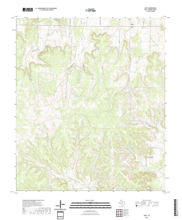
2022 Map of Hext
USGS Topo · Published 2022About this map
Hext sits at the junction of Ranch Rd 1221 and the local road network in northeastern Menard County. This landscape is defined by its numerous watering points, including McDougal Spring, Franklin Spring, and Indian Spring, which have long served as vital resources in this part of Texas. The terrain is a complex series of drainage systems, such as McDougal Draw and Franklin Draw, that carve through the limestone-underlaid hills. Local transportation and land use are centered around ranching and private aviation, evidenced by the Comanche Ridge Ranch Airport located near Comanche Ridge. Family-named roads like Coffey Ln, Garvin Ln, and Hilltop Rd offer clues for genealogists researching the rural residents who managed these vast acreage holdings. Smaller features like Cistern Spring and Muskhog Hollow further illustrate the localized naming of this cattle-country topography.
Find a feature on this map
36 named features on this map. Tap any name to fly to it.
Don’t see what you’re looking for? This feature index may not catch every label — zoom into the map to look around manually.
Map Details
Editions of this 2022 Hext Map
This is the sole edition of this map. No revisions or reprints were ever made.
Other maps of this area

1887 · Mason
USGS Topo · 1:125,000

1894 · Mason
USGS Topo · 1:125,000

1954 · Llano
USGS Topo · 1:250,000

1955 · Llano
USGS Topo · 1:250,000

1956 · Llano
USGS Topo · 1:250,000

1968 · Sheep Run Creek
USGS Topo · 1:24,000

1968 · London
USGS Topo · 1:24,000

1970 · Brewer Hollow
USGS Topo · 1:24,000
1970 · Calf Creek
USGS Topo · 1:24,000

1970 · East Elm Creek
USGS Topo · 1:24,000