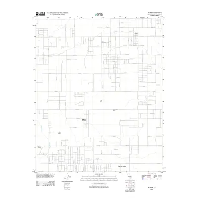
2012 Map of Hi Vista
USGS Topo · Published 2012About this map
Hi Vista and the high desert communities of Wilsona Gardens and Lake Los Angeles anchor this grid of the western Antelope Valley in the early 21st century. The landscape is defined by the rigid geometry of desert roads—numbered streets and lettered avenues—contrasted against prominent geologic formations. Distinctive volcanic remnants like Saddleback Butte, Piute Butte, and the Long Buttes rise sharply from the valley floor, providing essential landmarks in an otherwise flat expanse. The ephemeral drainage of Big Rock Wash cuts a wide, braided path across the southwestern corner, reflecting the area's arid hydrological character.
Find a feature on this map
112 named features on this map. Tap any name to fly to it.
Don’t see what you’re looking for? This feature index may not catch every label — zoom into the map to look around manually.
Map Details
Editions of this 2012 Hi Vista Map
This is the sole edition of this map. No revisions or reprints were ever made.
Other maps of this area

1930 · Joshua
USGS Topo · 1:24,000

1930 · Lovejoy Springs
USGS Topo · 1:24,000

1930 · Wilsona
USGS Topo · 1:24,000

1931 · Hi Vista
USGS Topo · 1:24,000

1933 · Lovejoy Springs
USGS Topo · 1:24,000

1934 · Joshua
USGS Topo · 1:24,000

1935 · Hi Vista
USGS Topo · 1:24,000
1935 · Wilsona
USGS Topo · 1:24,000

1937 · Shadow Mountains
USGS Topo · 1:48,000

1937 · Kramer
USGS Topo · 1:48,000