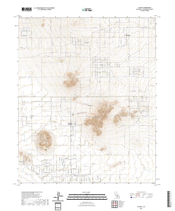
2021 Map of Hi Vista
USGS Topo · Published 2021About this map
Antelope Valley defines this portion of the high desert, where a series of prominent isolated peaks rise sharply from the flat basin floor. Hi Vista and Wilsona Gardens anchor the small residential footprints of the region, surrounded by a rigid grid of established and planned corridors such as E Ave J and E Ave K. The landscape is dominated by geological landmarks, most notably the sprawling Saddleback Butte and the distinct clusters of Long Buttes and Rocky Buttes. Drainage patterns are evident through the Big Rock Wash and the meandering Eller Slough, illustrating the hydrologic character of this arid environment. The map highlights specific recreational or survey markers like the Saddleback Butte Peak Tri Trl and Little Butte Tri Trl, indicating a landscape utilized for both geographic study and outdoor activity.
Find a feature on this map
59 named features on this map. Tap any name to fly to it.
Don’t see what you’re looking for? This feature index may not catch every label — zoom into the map to look around manually.
Map Details
Editions of this 2021 Hi Vista Map
This is the sole edition of this map. No revisions or reprints were ever made.
Other maps of this area

1930 · Joshua
USGS Topo · 1:24,000

1930 · Lovejoy Springs
USGS Topo · 1:24,000

1930 · Wilsona
USGS Topo · 1:24,000

1931 · Hi Vista
USGS Topo · 1:24,000

1933 · Lovejoy Springs
USGS Topo · 1:24,000

1934 · Joshua
USGS Topo · 1:24,000

1935 · Hi Vista
USGS Topo · 1:24,000
1935 · Wilsona
USGS Topo · 1:24,000

1937 · Shadow Mountains
USGS Topo · 1:48,000

1937 · Kramer
USGS Topo · 1:48,000