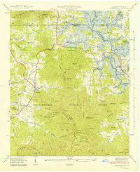
1942 Map of Hiawassee
USGS Topo · Published 1942About this map
Chatuge Reservoir dominates the northern landscape of this 1940s survey, illustrating the transformative impact of the Tennessee Valley Authority on the Hiwassee River valley. The reservoir's expanding shoreline wraps around the Georgia-North Carolina border, reaching toward settlements like Friendship and Hiawassee. To the south, the terrain rises sharply into the Chattahoochee National Forest, where steep ridges like Cedarcliff Mountain and Wolfpen Ridge define the watershed.
Find a feature on this map
72 named features on this map. Tap any name to fly to it.
Don’t see what you’re looking for? This feature index may not catch every label — zoom into the map to look around manually.
Map Details
Editions of this 1942 Hiawassee Map
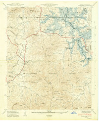
2 editions found
Other maps of this area

1886 · Dahlonega
USGS Topo · 1:125,000

1892 · Dahlonega
USGS Topo · 1:125,000

1896 · Dahlonega
USGS Topo · 1:125,000

1903 · Dahlonega
USGS Topo · 1:125,000

1935 · Coosa Bald
USGS Topo · 1:24,000

1935 · Peachtree
USGS Topo · 1:24,000

1935 · Osborn
USGS Topo · 1:24,000

1935 · Shooting Creek
USGS Topo · 1:24,000

1935 · Wayah Bald
USGS Topo · 1:48,000

1935 · Tray Mountain
USGS Topo · 1:24,000