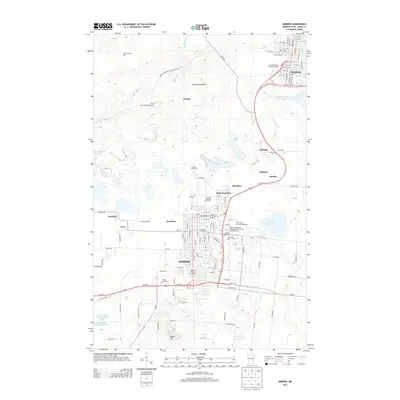
2013 Map of Hibbing
USGS Topo · Published 2013About this map
The Laurentian Divide cuts across this portion of the Mesabi Iron Range, where the industrial legacy of northeastern Minnesota is etched into the landscape. Significant mining infrastructure is evidenced by the Hull Rust Mine View and the massive water management systems of the Whitney Clearwater Basin and Mesabi Chief Tailings Basin Three. The city of Hibbing serves as the central hub, surrounded by smaller historical settlements and locations such as Kerr Location, Ruby Junction, and Kitzville.
Find a feature on this map
47 named features on this map. Tap any name to fly to it.
Don’t see what you’re looking for? This feature index may not catch every label — zoom into the map to look around manually.
Map Details
Editions of this 2013 Hibbing Map
This is the sole edition of this map. No revisions or reprints were ever made.
Other maps of this area

1951 · Hibbing
USGS Topo · 1:24,000

1951 · Buhl
USGS Topo · 1:24,000

1952 · Keewatin
USGS Topo · 1:24,000

1952 · Riley
USGS Topo · 1:24,000

1952 · Silica
USGS Topo · 1:24,000

1952 · Little Swan
USGS Topo · 1:24,000

1954 · Hibbing
USGS Topo · 1:250,000

1955 · Dewey Lake SE
USGS Topo · 1:24,000

1955 · Dewey Lake
USGS Topo · 1:24,000

1957 · Hibbing
USGS Topo · 1:250,000