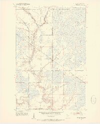
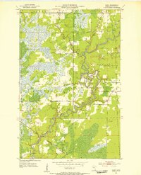
1952 Map of Little Swan
USGS Topo · Published 1954About this map
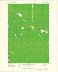
Swan River and its major tributaries define this mid-century landscape in St. Louis County, where the hydrological network of the East Swan River and West Swan River dominates the terrain. The small community of Little Swan sits near the Little Swan Dam, representing a pocket of settlement within a predominantly wetland and forested region. The infrastructure of the era is anchored by the Great Northern railroad, which cuts a straight path across the township lines of Stuntz and Lavell. Much of the western portion of the map is occupied by the Floodwood Memorial Forest, illustrating the importance of protected timberlands and natural drainage in northern Minnesota. Other small landmarks like Onega and the winding courses of Barber Creek and Dempsey Creek provide specific points of reference for local historians and genealogists tracking land use in this river-bottom territory.
Find a feature on this map
12 named features on this map. Tap any name to fly to it.
Don’t see what you’re looking for? This feature index may not catch every label — zoom into the map to look around manually.
Map Details
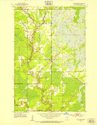
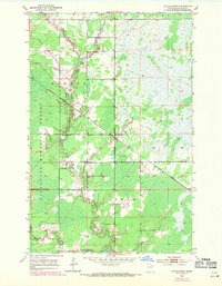
Editions of this 1952 Little Swan Map
3 editions found
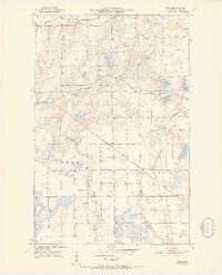
Other maps of this area
1951 · Kirk
USGS Topo · 1:24,000
1951 · Hibbing
USGS Topo · 1:24,000
1951 · Casco
USGS Topo · 1:24,000
1951 · Buhl
USGS Topo · 1:24,000
1952 · Riley
USGS Topo · 1:24,000

1954 · Hibbing
USGS Topo · 1:250,000

1957 · Hibbing
USGS Topo · 1:250,000
1957 · Hibbing
USGS Topo · 1:24,000

1958 · Hibbing
USGS Topo · 1:250,000
1963 · Upstead Lake
USGS Topo · 1:24,000