
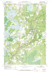
1951 Map of Casco
USGS Topo · Published 1953About this map
The St Louis River carves a winding path through the heart of St. Louis County in this 1951 survey, defining the boundaries of Mc Davitt, Clinton, and Lavell. The landscape is characterized by its sprawling marshlands and the industrial heritage of the Minnesota Iron Range, documented here by the Iron Range Resources and Rehabilitation Commission. The community of Casco sits at a rail junction where the Great Northern railroad cuts through the terrain, while further east, the Old Railroad Grade and several Gravel Pits trace the legacy of earlier extraction and transport efforts.
Find a feature on this map
13 named features on this map. Tap any name to fly to it.
Don’t see what you’re looking for? This feature index may not catch every label — zoom into the map to look around manually.
Map Details
Editions of this 1951 Casco Map
2 editions found
Other maps of this area

1951 · Eveleth
USGS Topo · 1:24,000

1951 · Kirk
USGS Topo · 1:24,000

1951 · Zim
USGS Topo · 1:24,000

1951 · Buhl
USGS Topo · 1:24,000

1952 · Little Swan
USGS Topo · 1:24,000

1954 · Hibbing
USGS Topo · 1:250,000

1957 · Hibbing
USGS Topo · 1:250,000

1958 · Hibbing
USGS Topo · 1:250,000

1963 · Meadowlands NW
USGS Topo · 1:24,000
1963 · Kelsey
USGS Topo · 1:24,000