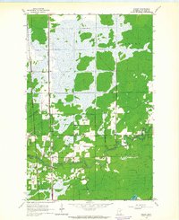
1963 Map of Kelsey
USGS Topo · Published 1964About this map
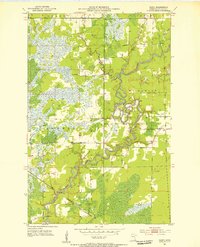
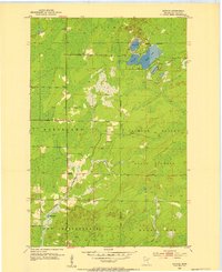
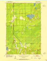
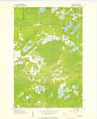
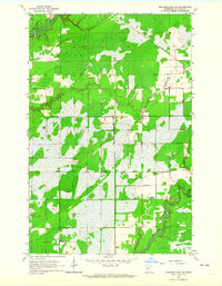
The Whiteface River snakes through the center of this 1963 survey, defining a landscape of low-lying wetlands and scattered settlements in St. Louis County. This era captures the industrial and transit network of the Iron Range, where the Duluth Missabe and Iron Range and Great Northern railroads intersect near the small community of Sax. The settlement of Kelsey serves as a local hub, situated just north of the river bend where the Community Ch and Riverside Cem are located. To the east, the Cotton Lookout Tower stands as a sentinel over the surrounding timber and marshland. The map provides a detailed view of the rural infrastructure during the early 1960s, including several Gravel Pit sites and the winding course of Deadmans Creek as it feeds into the primary river system.
Find a feature on this map
17 named features on this map. Tap any name to fly to it.
Don’t see what you’re looking for? This feature index may not catch every label — zoom into the map to look around manually.
Map Details
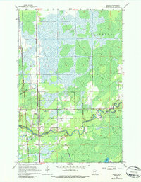
Editions of this 1963 Kelsey Map
2 editions found
Other maps of this area
1951 · Central Lakes
USGS Topo · 1:24,000
1951 · Zim
USGS Topo · 1:24,000
1951 · Casco
USGS Topo · 1:24,000
1953 · Canyon
USGS Topo · 1:24,000
1953 · Payne
USGS Topo · 1:24,000

1954 · Hibbing
USGS Topo · 1:250,000
1956 · Cotton
USGS Topo · 1:24,000

1957 · Hibbing
USGS Topo · 1:250,000

1958 · Hibbing
USGS Topo · 1:250,000
1963 · Meadowlands NW
USGS Topo · 1:24,000