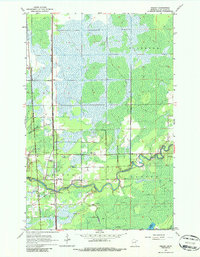
1963 Map of Kelsey
USGS Topo · Published 1986About this map
The Whiteface River snakes through the southern reaches of this landscape, anchoring a region of transition between timbered lowlands and industrial development. Two major rail corridors, the Great Northern and the Duluth Missabe and Iron Range, define the movement of iron and freight through the townships of Ellsburg, Kelsey, and Cotton. Near the river's bend, the community of Kelsey serves as a local hub, supported by the Community Ch and the Riverside Cem. Further north along the tracks, the siding at Sax and the settlement of Dumblane mark the thin line of habitation against the surrounding wetlands. To the east, the Cotton Lookout Tower provides a high point for forest surveillance above the drainage of Deadmans Creek, while numerous Gravel Pit sites indicate the active extraction of resources to support local infrastructure.
Find a feature on this map
16 named features on this map. Tap any name to fly to it.
Don’t see what you’re looking for? This feature index may not catch every label — zoom into the map to look around manually.
Map Details
Editions of this 1963 Kelsey Map
2 editions found
Other maps of this area

1951 · Central Lakes
USGS Topo · 1:24,000

1951 · Zim
USGS Topo · 1:24,000

1951 · Casco
USGS Topo · 1:24,000

1953 · Canyon
USGS Topo · 1:24,000

1953 · Payne
USGS Topo · 1:24,000

1954 · Hibbing
USGS Topo · 1:250,000

1956 · Cotton
USGS Topo · 1:24,000

1957 · Hibbing
USGS Topo · 1:250,000

1958 · Hibbing
USGS Topo · 1:250,000

1963 · Meadowlands NW
USGS Topo · 1:24,000