
1951 Map of Central Lakes
USGS Topo · Published 1953About this map
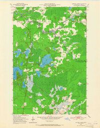
Central Lakes serves as the focal point of this 1951 survey, situated along the Duluth Winnipeg and Pacific railroad line. The settlement features a Community Hall and several scattered structures, marking a small human footprint within a landscape dominated by timber and water. This portion of the Mesabi Range hinterland is defined by its complex hydrology, where the St Louis River flows across the northern edge while a dense network of smaller bodies like Elliott Lake, Anchor Lake, and Crystal Lake dot the central basin.
Find a feature on this map
25 named features on this map. Tap any name to fly to it.
Don’t see what you’re looking for? This feature index may not catch every label — zoom into the map to look around manually.
Map Details
Editions of this 1951 Central Lakes Map
4 editions found
Other maps of this area

1951 · Palo
USGS Topo · 1:24,000

1951 · Gilbert
USGS Topo · 1:24,000

1951 · Eveleth
USGS Topo · 1:24,000

1951 · Zim
USGS Topo · 1:24,000

1951 · Makinen
USGS Topo · 1:24,000

1954 · Hibbing
USGS Topo · 1:250,000

1956 · Cotton
USGS Topo · 1:24,000

1956 · Whiteface
USGS Topo · 1:24,000

1957 · Hibbing
USGS Topo · 1:250,000

1958 · Hibbing
USGS Topo · 1:250,000