
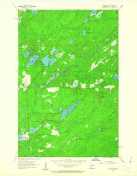
1956 Map of Whiteface
USGS Topo · Published 1958About this map
The Cloquet River and Whiteface River converge within this mid-century landscape, carving through the dense timber of the Cloquet Valley. The area is defined by a heavy concentration of glacial lakes and wetlands, including the string of Washusk Lakes and the prominent Long Lake. The Duluth Winnipeg and Pacific railroad line runs along the western edge of the quadrangle, serving the small settlement at Whiteface. This rail corridor provided essential transport for the region's logging industry, which is reflected in the establishment of the Cloquet Valley State Forest covering much of the southern terrain. Scattered smaller bodies of water like Pioneer Lake and Wilson Lake suggest a landscape used for both natural resource extraction and early recreation in the northern woods of St. Louis County.
Find a feature on this map
32 named features on this map. Tap any name to fly to it.
Don’t see what you’re looking for? This feature index may not catch every label — zoom into the map to look around manually.
Map Details
Editions of this 1956 Whiteface Map
2 editions found
Other maps of this area

1951 · Central Lakes
USGS Topo · 1:24,000

1951 · Makinen
USGS Topo · 1:24,000

1953 · Canyon
USGS Topo · 1:24,000

1953 · Shaw
USGS Topo · 1:24,000

1953 · Boulder Lake Reservoir
USGS Topo · 1:24,000

1954 · Hibbing
USGS Topo · 1:250,000

1956 · Cotton
USGS Topo · 1:24,000

1957 · Hibbing
USGS Topo · 1:250,000

1957 · Markham
USGS Topo · 1:62,500

1957 · Comstock Lake
USGS Topo · 1:24,000