
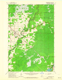
1963 Map of Meadowlands NW
USGS Topo · Published 1964About this map
The St Louis River and Whiteface River dominate this early 1960s landscape in St. Louis County, where the water-rich terrain of northern Minnesota is meticulously documented. The geography is defined by extensive wetlands and meandering waterways, including Stony Creek and Joki Creek, which flow through the townships of Lavell, Toivola, and Kelsey. The map highlights a largely rural and industrial interface, evidenced by localized Gravel Pits and the presence of the Great Northern waterway. Small navigational landmarks like the Rapids on the Whiteface River provide specific points of interest for those studying the natural drainage and historic land use of the region before modern development altered the drainage patterns of these northern woods.
Find a feature on this map
10 named features on this map. Tap any name to fly to it.
Don’t see what you’re looking for? This feature index may not catch every label — zoom into the map to look around manually.
Map Details
Editions of this 1963 Meadowlands NW Map
This is the sole edition of this map. No revisions or reprints were ever made.
Other maps of this area

1951 · Zim
USGS Topo · 1:24,000

1951 · Casco
USGS Topo · 1:24,000

1952 · Little Swan
USGS Topo · 1:24,000

1953 · Payne
USGS Topo · 1:24,000

1954 · Hibbing
USGS Topo · 1:250,000

1957 · Hibbing
USGS Topo · 1:250,000

1958 · Hibbing
USGS Topo · 1:250,000

1963 · Elmer
USGS Topo · 1:24,000
1963 · Meadowlands
USGS Topo · 1:24,000
1963 · Kelsey
USGS Topo · 1:24,000