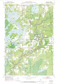
1951 Map of Casco
USGS Topo · Published 1971About this map
The St Louis River winds with intense meanders through the central and southern portions of this landscape, reflecting the heavy wetlands and marshy terrain characteristic of the Iron Range region during the mid-20th century. At the southern edge, the small settlement of Casco sits along the Burlington Northern railroad line, serving as a focal point for the local community and industry. The presence of a Substation and several Gravel Pits suggests the area's ongoing industrial utility, while the Old Railroad Grade in the northeast hints at previous transportation routes that once served the timber or mining sectors.
Find a feature on this map
14 named features on this map. Tap any name to fly to it.
Don’t see what you’re looking for? This feature index may not catch every label — zoom into the map to look around manually.
Map Details
Editions of this 1951 Casco Map
2 editions found
Other maps of this area

1951 · Eveleth
USGS Topo · 1:24,000

1951 · Kirk
USGS Topo · 1:24,000

1951 · Zim
USGS Topo · 1:24,000

1951 · Casco
USGS Topo · 1:24,000

1951 · Buhl
USGS Topo · 1:24,000

1952 · Little Swan
USGS Topo · 1:24,000

1954 · Hibbing
USGS Topo · 1:250,000

1957 · Hibbing
USGS Topo · 1:250,000

1958 · Hibbing
USGS Topo · 1:250,000

1963 · Meadowlands NW
USGS Topo · 1:24,000