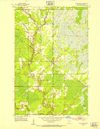
1952 Map of Little Swan
USGS Topo · Published 1954About this map
Swan River and its various branches, including the West Swan River and East Swan River, dominate this mid-century landscape in St. Louis County. The area is characterized by the expansive wetlands and timber of the Floodwood Memorial Forest, where the small settlement of Little Swan is situated near the Little Swan Dam. The geographic layout reveals a remote region transitioning from a wilderness economy to one connected by rail, evidenced by the Great Northern tracks cutting diagonally across the terrain toward the settlement of Onega.
Find a feature on this map
13 named features on this map. Tap any name to fly to it.
Don’t see what you’re looking for? This feature index may not catch every label — zoom into the map to look around manually.
Map Details
Editions of this 1952 Little Swan Map
3 editions found
Other maps of this area

1951 · Kirk
USGS Topo · 1:24,000

1951 · Hibbing
USGS Topo · 1:24,000

1951 · Casco
USGS Topo · 1:24,000

1951 · Buhl
USGS Topo · 1:24,000

1952 · Riley
USGS Topo · 1:24,000

1952 · Little Swan
USGS Topo · 1:24,000

1954 · Hibbing
USGS Topo · 1:250,000

1957 · Hibbing
USGS Topo · 1:250,000

1957 · Hibbing
USGS Topo · 1:24,000

1958 · Hibbing
USGS Topo · 1:250,000