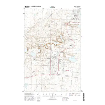
2016 Map of Hibbing
USGS Topo · Published 2016About this map
The Laurentian Divide cuts through this portion of the Mesabi Range, a geographical marker that separates the watersheds of the northern continent. The landscape is profoundly shaped by the region's industrial heritage, dominated by massive reclamation and water management features such as the Hibbing Taconite Tailings Basin and the Whitney Clearwater Basin. These industrial footprints wrap around long-established residential and commercial centers, including the grid-patterned streets of Hibbing and Chisholm.
Find a feature on this map
100 named features on this map. Tap any name to fly to it.
Don’t see what you’re looking for? This feature index may not catch every label — zoom into the map to look around manually.
Map Details
Editions of this 2016 Hibbing Map
This is the sole edition of this map. No revisions or reprints were ever made.
Other maps of this area

1951 · Hibbing
USGS Topo · 1:24,000

1951 · Buhl
USGS Topo · 1:24,000

1952 · Keewatin
USGS Topo · 1:24,000

1952 · Riley
USGS Topo · 1:24,000

1952 · Silica
USGS Topo · 1:24,000

1952 · Little Swan
USGS Topo · 1:24,000

1954 · Hibbing
USGS Topo · 1:250,000

1955 · Dewey Lake SE
USGS Topo · 1:24,000

1955 · Dewey Lake
USGS Topo · 1:24,000

1957 · Hibbing
USGS Topo · 1:250,000